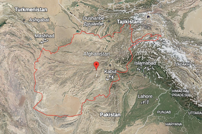
Afghanistan is a landlocked country located at the crossroads of Central and South Asia. It is often described as the “Heart of Asia” due to its strategic location connecting the Middle East, Central Asia, the Indian subcontinent, and the Far East. The country is characterized by rugged, mountainous terrain, arid climates, and limited arable land.
Total Area: 652,230 sq km (252,072 sq mi) – roughly the size of Texas, USA, or France.
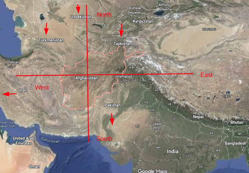
Borders (total length: 5,987 km):
- North: Turkmenistan (804 km), Uzbekistan (144 km), Tajikistan (1,357 km)
- East & South: Pakistan (2,670 km – including the disputed Durand Line)
- West: Iran (921 km)
- Northeast: China (91 km) via the narrow Wakhan Corridor
Major Physical Features
1. Mountain Ranges
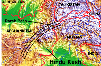
The Hindu Kush mountain range is the dominant geographical feature, running northeast to southwest across the country. It is a geological continuation of the Himalayas, Pamirs, and Karakoram ranges.
- Highest Point: Noshaq (7,492 m / 24,580 ft) – located in the northeastern Wakhan Corridor near Pakistan.
- Key Peaks & Passes: The Salang Pass (3,878 m) is a critical route connecting Kabul to the north; the Khyber Pass (on the border with Pakistan) is historically significant for invasions and trade.
- Other ranges: Pamir Mountains (in the east), Spin Ghar (east), Selseleh-e Safīd Kūh (Paropamisus range in the west).
2. River Systems
Most rivers originate from the Hindu Kush and drain into inland lakes or deserts; Afghanistan has no outlet to the open sea (endorheic basins dominate).
- Amu Darya (Oxus River): Forms the northern border with Tajikistan and Uzbekistan. It is the longest river in Afghanistan.
- Helmand River: The longest river entirely within Afghanistan (1,150 km), flowing southwest into the Sistan Basin (shared with Iran).
- Kabul River: Flows east past the capital and into the Indus River in Pakistan.
- Hari River: Flows west into Turkmenistan, where it disappears in the Karakum Desert.
- Other rivers: Panj River (source of the Amu Darya), Balkh River, Farah River.
3. Lakes
Most are small, saline, and seasonal.
- Band-e-Amir: A series of six deep-blue lakes in Bamyan Province, dammed by natural travertine (calcium carbonate) barriers – Afghanistan’s first national park.
- Hamun-e-Helmand (Sistan Basin): A seasonal freshwater lagoon/wetland shared with Iran, fed by the Helmand River.
4. Deserts and Plateaus
- Registan Desert: A vast, sandy desert in the south (Kandahar/Helmand provinces).
- Dasht-e-Margo (Desert of Death): A barren, arid plain in the southwest.
- Central Highlands (Hazarajat): A rugged plateau of mountains and deep valleys in central Afghanistan.
Climate
Afghanistan has an arid to semi-arid continental climate with extreme temperature variations.
- Winter (Dec-Feb): Very cold in the mountains (as low as -30°C / -22°F); heavy snow blocks high passes. Lowlands are cold but less severe.
- Summer (Jun-Aug): Hot to scorching in the lowland plateaus and deserts (up to 50°C / 122°F). Cooler in the high mountains.
- Precipitation: Low (average 200-350 mm/year). Most rain/snow falls in winter and spring. The southeast monsoon occasionally affects the eastern valleys.
Natural Regions
From north to south:
- Northern Plains (Bactrian Plain): Fertile foothills and river valleys north of the Hindu Kush – historically a granary (wheat, cotton, fruits).
- Central Highlands (Hindu Kush & Hazarajat): High mountains, deep gorges, alpine meadows (small population, mostly pastoral).
- Eastern Slopes & Kabul Basin: Relatively wetter, more forested (pine, fir), includes the capital, Kabul.
- Southern & Southwestern Plateaus & Deserts: Arid, sparsely vegetated, with oases in river valleys (e.g., Kandahar, Helmand).
Natural Resources
- Minerals: Significant deposits of copper (one of the world’s largest deposits at Mes Aynak), iron ore, gold, lithium, cobalt, rare earth elements, and gemstones (lapis lazuli from Badakhshan).
- Energy: Limited proven oil and natural gas (northern provinces), but significant potential for hydroelectric power (from mountain rivers) and solar/wind energy.
- Agricultural land: Only about 12% is arable; irrigation is essential. Major crops include wheat, opium poppy, fruits (pomegranates, grapes, melons), and nuts.
Environmental Challenges
- Deforestation: Centuries of fuelwood collection and illegal logging.
- Desertification & Drought: Recurring severe droughts exacerbated by climate change.
- Soil salinization: Due to poor irrigation management.
- Water scarcity: Heavily dependent on rivers that flow into downstream neighbors (Iran, Pakistan, Turkmenistan), leading to regional tensions.
- Earthquakes: Frequent seismic activity due to the collision of the Eurasian and Indian tectonic plates (Hindu Kush is a major earthquake zone).
Key Geographic Data (Summary Table)
| Feature | Detail |
|---|---|
| Capital | Kabul (elevation ~1,790 m / 5,873 ft) |
| Largest City | Kabul (approx. 4.5 million) |
| Highest Point | Noshaq (7,492 m) |
| Lowest Point | Amu Darya bank near Khamyab (258 m) |
| Land Use | 58% pasture, 12% arable, 3% forest, 27% other (mostly barren rock/desert) |
| Major Biomes | Temperate desert, alpine steppe, dry shrubland, montane grassland |
Video Reference
Leave a Reply